
Trail Map
12 miles of trails, segment by segment
Ipswich River Wildlife Sanctuary has 12 miles of interconnecting trails, all on foot, shown on Mass Audubon's official trail map. Download the PDF from Mass Audubon's trails page, or open its digital map on your phone. The trails start at the visitor center on Bradstreet Hill and fan out through forest, meadow and wetland: over boardwalks, up a drumlin, on top of an esker, past a vernal pool and to the 1905 Rockery. The Observation Tower near Bunker Meadows is closed until further notice.
Trails at a Glance
Trail Lengths
Mass Audubon publishes descriptions and lengths for these seven trails, the core of the network around the visitor center:
- Drumlin Trail — 1.3 miles
- Rockery Trail — 0.5 miles
- South Esker Trail — 0.5 miles
- Ipswich River Trail — 0.4 miles
- Bradstreet Lane — 0.3 miles
- North Esker Trail — 0.3 miles
- Stone Bridge Trail — 0.2 miles
The rest of the network appears on the map with distances marked segment by segment, junction to junction, rather than as single totals. Add the segments along your route to plan a loop.
The Main Trails
Drumlin Trail
At 1.3 miles, the Drumlin Trail is the longest of the described trails. It follows an old carriage road around the lower slopes of the glacial drumlin it's named for. Mass Audubon calls it wide and easy, and it connects to many other trails. Stop at the wisteria arbor in spring.
Rockery Trail
The 0.5-mile Rockery Trail is the sanctuary's most-visited. It starts at the top of the hill and crosses wetland boardwalks and bridges, where Mass Audubon says you can watch waterfowl, red-winged blackbirds, muskrats and otters, then reaches the Rock Grotto. Pick up the "Guide to Trees Along the Rockery Loop" card deck at the visitor center. More on the Rockery.
South Esker and North Esker Trails
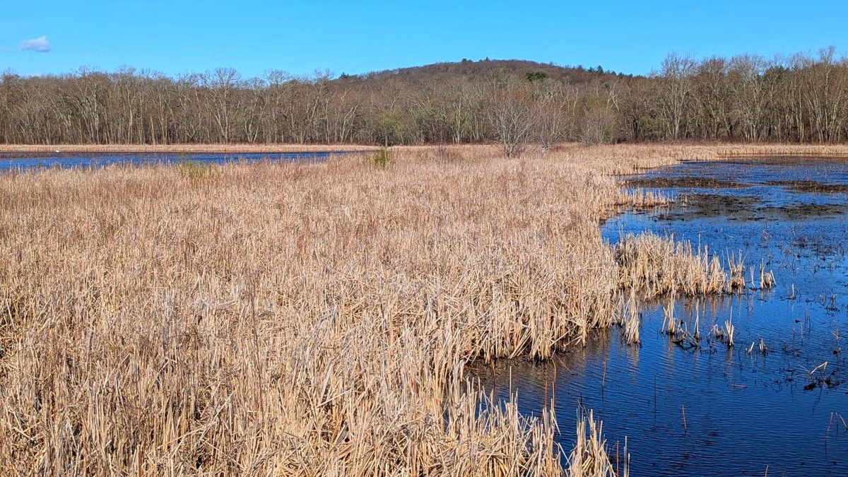
The South Esker Trail (0.5 mile) runs along a narrow, raised ridge left by a glacial stream, with views of the Ipswich River, marsh and cattails; watch your footing on the glacial rocks. The North Esker Trail (0.3 mile) runs between two wetlands, overlooks Hassocky Meadow, and leads on to the outer trails.
Stone Bridge Trail
Short (0.2 mile) and worth it: the stone bridge is a good place to watch beavers, their lodges and other animals swimming by.
Ipswich River Trail and Bradstreet Lane
The Ipswich River Trail (0.4 mile) leads off the Bunker Meadows Trail to the river's edge and the canoe landing, where rental boats are kept. Bradstreet Lane (0.3 mile) is an old carriage road near the visitor center with views of fields and woods; look for eastern bluebirds along the field edge.
Other Trails on the Map
Mass Audubon's map also names the Hemlock, Ruffed Grouse and Innermost Trails near the visitor center; the Bunker Meadows Trail and Waterfowl Pond Trail; the Averill's Island Trail and Averill's Island Loop out across the wetlands on boardwalk; the Mill Pond Trail, Red Pine Trail, Agawam Path and Spur Trail near Mill Pond; and in the north, the Mile Brook, Hassocky Meadow, White Pine Loop, Bridge and Fox Field Trails.
Landmarks to Find
- Visitor Center and the Barn, at the top of Bradstreet Hill by the parking lot.
- The Rock Grotto, beside Rockery Pond.
- The vernal pool, just below the visitor center.
- Waterfowl Pond and Mill Pond.
- Hassocky Meadow and Fox Field.
- The gazebo, near the South Esker Trail.
- The canoe access on the Ipswich River, at the end of the Ipswich River Trail.
- The Observation Tower over Bunker Meadows — closed until further notice.
- Islands in the wetlands: Averill's, Fox, Pine, Grape and Perkins Islands (Perkins Island is the canoe-access campground).
Beyond the Boundary
The map shows land labeled Bradley Palmer State Forest across the river to the east, the Great Wenham Swamp to the south, and the Topsfield Linear Common rail trail (a bike trail) off the sanctuary's southwest corner. Those are separate properties with their own rules; see things to do in Topsfield.
Trail Rules
Foot travel only, and stay on the trails. Mass Audubon offers day passes for powered mobility devices. No dogs, bikes or horses. See rules and regulations, and hiking at Ipswich River for suggested walks.

Trail Map FAQ
How many miles of trails are at Ipswich River Wildlife Sanctuary?
12 miles of interconnecting trails, according to Mass Audubon.
Where can I get a trail map of Ipswich River Wildlife Sanctuary?
Download the PDF from Mass Audubon's Ipswich River trails page, or use its digital map on your phone.
What is the most popular trail at Ipswich River?
The Rockery Trail, 0.5 mile, which Mass Audubon calls its most-visited. It crosses wetland boardwalks to the 1905 Rock Grotto.
Is the observation tower at Ipswich River open?
No. Mass Audubon says the Observation Tower is closed until further notice for safety.
Can you bike the trails at Ipswich River Wildlife Sanctuary?
No. Mass Audubon allows foot travel only. The Topsfield Linear Common rail trail, off the sanctuary's southwest corner, is open to bikes.